Iceland North

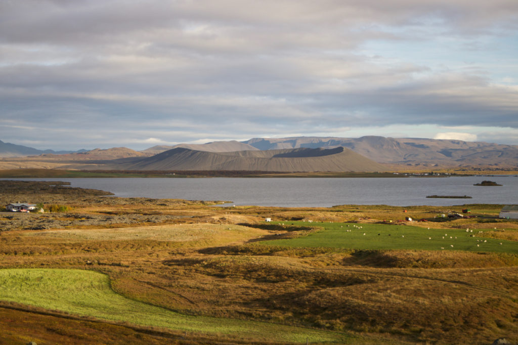
From Myvatn, we headed west.  I got this picture looking out over the lake as we left.   You can see an old volcana just behind the lake.

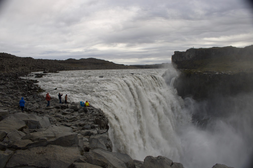
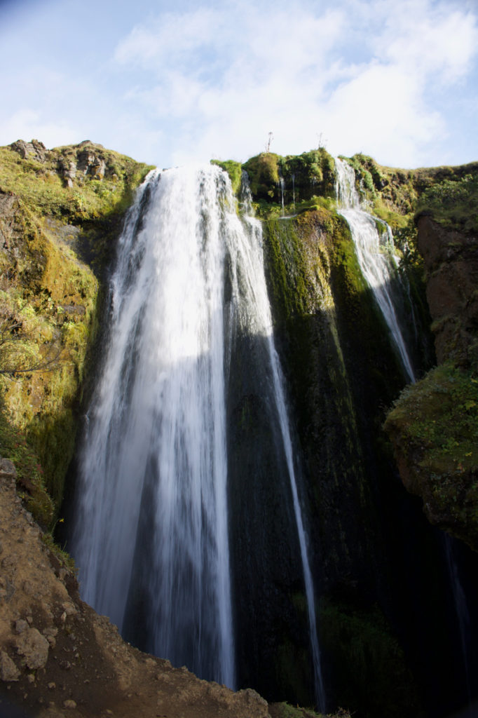
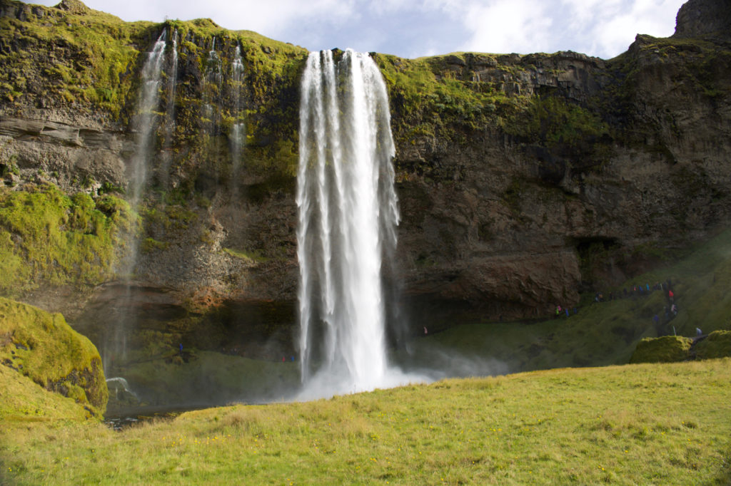
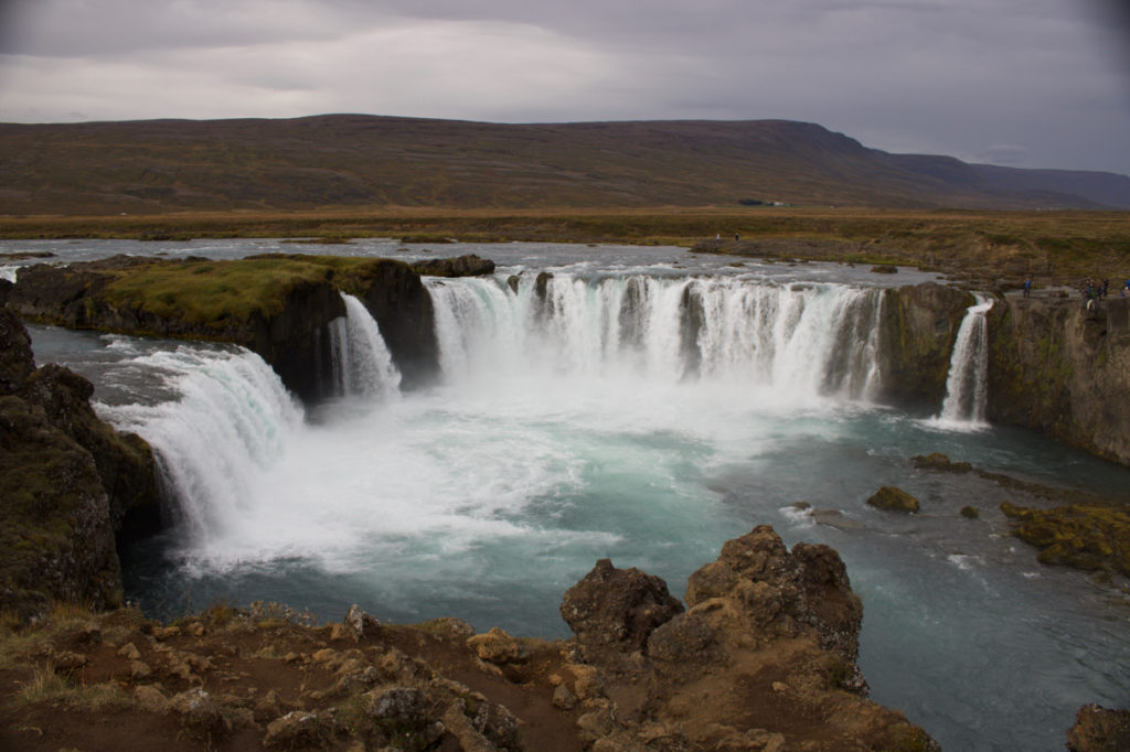
We travelled most of the day overland to the Goðafoss waterfall.  Supposedly the leader who agreed to have Iceland adopt Christianity discarded all his idols of the old Norse gods into the Goðafoss.  We arrived late enough in the day that after walking around the falls we decided to camp on the grounds beside the river.

This was the only night we had a clear view of the Northern Lights.  On other nights we had seen an occasional smudge of colour but not much more than I have seen in Canada in the past.  On this night, we had a short display of vivid and well-defined streaks of colour.  I was a bit surprised at how much the lights moved over time.  Unfortunately I lost an argument with our new camera and so did not get any pictures.

The next morning, we toured the falls again.  The lighting was a bit better on this second day.

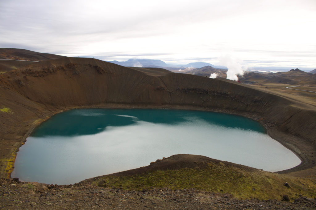
From there we continued west and took some time out to hike around another set of volcano craters.   While walking the rim of one, we got this shot of the next one over.

We then continued on and spent the night in Sauðárkrókur, a town on the central north coast.

Iceland Myvatn

Last entry, we spent the night in Reykjahlíð on the shores of the Myvatn lake.  The lake itself is very picturesque, but the interesting stuff is in the nearby hills.  Just east of town, there is a very active geothermal area including an electricity generation plant at Kafla.

This first video gives an idea of why they can produce power here.

The second has me repeating the phrase “Bubble, bubble, toil and trouble” for some reason.

We also walked a bit around the power station and some some old craters like this.

The steam in the background on that one is from some of the power generation equipment.

We took a break in the later afternoon by hitting the mineral baths back in Reykjahlíð before heading off to Godafoss for the night.  The entire drive there, Liane was concerned the mineral waters would make me drowsy.

Iceland East

We continued heading north along the east coast, skirting the Vatnajökull glacier. This glacier is one of the two or three largest glaciers in Europe (where it ranks depends on how you define largest – area or volume, and how you define Europe). The glacier is up to a kilometre thick in spots and has many points where the ice flows down the values to form rivers.

Here is the “lagoon” at one of the outlet points.  These icebergs are fairly small – the largest in this picture are about the size of a house.

We spent the night in Hofn being rocked to sleep by the howling wind.  One of the dangers they warn tourists about is having the local winds catch your car door as you open it and apply enough torque to completely ruin the hinge and door.  So we got used to reminding each other to hold the door.

From Hofn, we headed north east initially along the coast to the fishing village of Djúpivogur then across country to Reykjahlíð.  Djúpivogur strengthened our long held belief that we just don’t do cities to also include towns or villages.  I know some people love touring them but not our thing.  However, here is a shot from our trek across country.

Along the way we saw a sign for the Dettifoss and made a hurried turn on to the 30k diversion to the most powerful falls in Europe.  I’m not sure what was worse – driving 30k of washboard road bad enough to make a BC logging road proud, knowing we had to do it again, or looking across the river at the very modern observation deck and tour busses on the other side.  There are roads in to each side of Dettifoss and I guess we got the wrong one.  In our defense, I think our side had the better view.

From there to Reykjahlíð was an uneventful but enjoyable drive. We arrived a bit late in the day and kept with our pattern of alternating camping and using a hotel.

Iceland landscape

The landscape in Iceland is fascinating.  The island has volcanos (remember the 2010 air transport shutdown?), glaciers, and significant erosion all going on.   Glaciers release a lot of water from the highlands that forms rivers and these a large number of small falls and the occasional large one. Because much of the land is recent, in geological terms, erosion hasn’t had time to smooth everything out and create gentle curves.  Most of what we see consists of a flat coastal plain, a moderately rolling tablelands at a few hundred metres and near vertical cliffs in between.

Where there are softer soils and rocks, the river erosion often creates canyons with near vertical walls.  Here is a shot from Fjaðrárgljúfur (no idea how to even start pronouncing these names).

Even the flat parts of the land have an unfamiliar feel to them.

One thing Liane and I haven’t understood is the pattern of development here.  While villages are typically right on the coast, as expected for a fishing based culture, many farms are placed right at the bottom of huge vertical cliffs.  We don’t know why they don’t get destroyed by falling rocks and slides.  There are a few museums around Iceland about the settlement process.  Perhaps visiting one of those later in the trip will help us understand.

Iceland South and East

We headed east, passing through the coastal lowlands.  We saw glaciers,

falls (this picture is from the river behind the Skogafoss),

and black sand beaches.

Along the way, we spent a night in a hotel in Vik because I was too tired to deal with the camper.  We camped the following night in Hofn. We heard later that a hotel was a really good idea for that first night – the campground at Vik was having problems handling the number of tourists and ran out of hot water.

That is a recurring theme here.  Iceland has received an incredible boost in tourism over the last few years.  In many ways, they are still struggling to catch up in some areas.  The main road is very good.  The side roads can be a bit rough even though some have significant traffic.

Reykjavic and South

We’ve been here about a week now.  The first three days were defined by jet-lag.  No idea why but it seems to have hit us harder this time than on previous trips.   We slept about 15 hours the first night and then promptly crashed for a couple more after we ate.  If this is an indicator, our upcoming Reykjavic to Cairns flight should put us down for a week or two.

As others have expounded, Iceland is very expensive.  A simple main course for dinner or lunch seems to run around 3000kr which is about $35 (Cdn $ for those in the land of Trump).  Something at a nicer restaurant fairly quickly gets to 5000kr or $60.  Then add wine (1500kr) and maybe an appetizer or dessert (1700kr each) and you can see it starts to add up.  Even breakfast can easily be 1900kr.  Accommodations, gas, and other goods all seem to scale to match.

On Monday, we picked up our vehicle for our trek around Iceland. There was the minor confusion as I took us to the wrong rental agency (Go Iceland and Go Campers Iceland are different companies, though both rent campers).  A few thousand kr later for cab fares, we’re at the correct agency.   I’m not going to expound too much on how unimpressed we are with the camping aspect of the vehicle.  Suffice to say it isn’t very well designed.  It does drive well and we’ve appreciated its size and clearance on our trip, but it isn’t an ideal setup for extended camping.   This is a our third camper van trip and the first we’ve had any issues.

That all said, we are enjoying ourselves.  We’ve voyaged south along the coast.  Our first stop was to see a couple of falls. The Gljúfrabúi Waterfall

and the Seljalandsfoss

are only about a ten minute walk apart.  If you look very closely at the second picture, you can see a line of people walking behind the cascade..

We camped at a site very close to the Gljúfrabúi fall for our first night.  The Gljúfrabúi is also referred to as the Troll’s Gorge waterfall after the small cut in the cliff which houses it.  And where there is a Troll’s Gorge, there is a Troll’s Cave.

Happy Anniversary

September 1.   A while back, a pile of people gathered in Waterloo, Ont. on that day to wish us well.  It’s been 27 years since then.  Doesn’t feel that long but the calendar doesn’t lie.  Not all the people who were there are still with us.   We do miss them.

Fortunately, our landlord decided it was time to get into the vacation rental market with “our” place.  No idea why this is expected to work better now than in past, but it is his call.   We’d been itching to travel for a couple of years now so the change was welcome.  Yeah, homeless again.

We started out by travelling to Mt. Baldy, a ski hill near Osoyoos, where we frequently ski in winter.  The main purpose of the trip was to drop off our ski gear ready for our return.  A second goal was that I have wanted to explore that area and the mountain in particular during the summer for a few years now.  We didn’t have much time to explore but what we did was fun.

So, where did I take Liane out for our anniversary?  We walked up the ski hill.  Had a lunch of water, mixed nuts and dried fruit at around 7000ft.   High class, B.C. style.   It was really quite interesting seeing the terrain we ski all the time without the snow.  That mountain is steep!  And there are rocks everywhere.  We will have a new appreciation for it next winter.

The other big feature of the area at this time is smoke.  There are more than a hundred fires burning in BC and a fair number in the U.S.A. just south of there.  The first day up there, we could smell the occasional hint of smoke.  On the second day, it was everywhere.  Our drive back to Victoria was even worse to the point Liane was having some mild breathing problems in some of the valleys.

I took a photo of the area west of the mountain.  It shows the purple of the smoke covering the whole area.